Talking Points: Event Mapping

A collection of imagery and sources designed to explore event mapping.

Please note that this page contains links to external websites and has videos from external websites embedded. At the time of creating, AccessArt checked all links to ensure content is appropriate for teachers to access. However, external websites and videos are updated and that is beyond our control. 

Please let us know if you find a 404 link, or if you feel content is no longer appropriate. 

We strongly recommend as part of good teaching practice that teachers watch all videos and visit all websites before sharing with a class. On occasion there may be elements of a video you would prefer not to show to your class and it is the teacher’s responsibility to ensure content is appropriate. Many thanks.

*If you are having issues viewing videos it may be due to your schools firewall or your cookie selection. Please check with your IT department.*

This resource is free to access and is not a part of AccessArt membership.

ages 9-11
ages 11-14
free to access

Event mapping is useful way to visualise the event space. It can help organisers to spot any potential issues before the event,  plan ahead and track the progress of the planning.

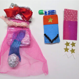
There are different approaches to event mapping you can explore; creating a 3D physical model of a space or working digitally to create a virtual model of a space.

Explore the videos below to focus a discussion about what is possible. 

Paris Olympics: OnePlan

You might like to show some clips from the video above on mute to give pupils a feel for the virtual capabilities of digital mapping.

Paris will be hosting the events across the city in historical and cultural venues. Most of the games are being held in pre-existing stadiums. Explore the competition venue concept map for the Paris Olympics and Paralympics.

Questions to Ask Children

Why do you think digital mapping can be useful when planning big events?

Does the digital mapping remind you of anything? 

What are the benefits/disadvantages of mapping out an event digitally?

London Olympics 2012

Find out more about Daniel Boyle’s vision for the 2012 Olympic Opening Ceremony here.

Go to minute 3:30 to see specifically how they have used 3D model in their planning.

Questions to Ask Children

After seeing both digital and hand made models for events mapping, which is your favourite and why?

What are the benefits/disadvantages of having a 3D model?

You May Also Like...

image_pdfimage_print